|
USA Office (725) 222-1116 * Mon-Sat: 9am-5pm PST |
Philippine Office +63 946 362 6255* Mon-Sat: 9am-5pm PHT |
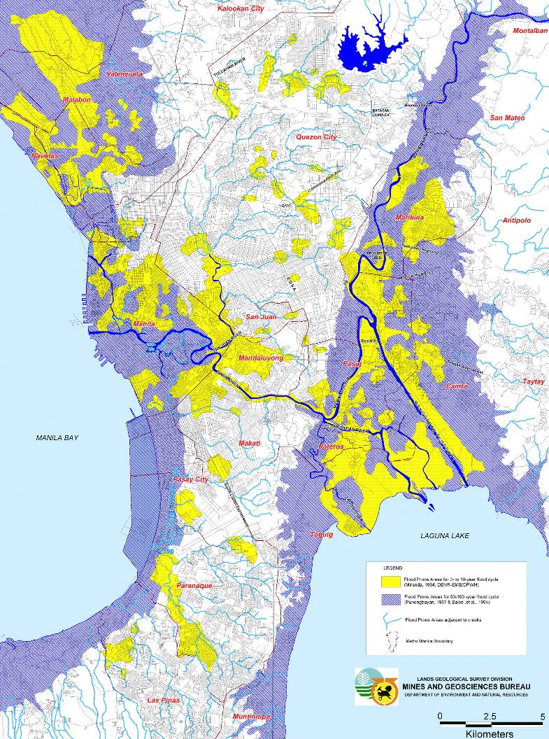
Most of the central area of Manila is free from flood, with the periphery areas having a higher probability of flooding.
Historical Flood Probability Map for Metro Manila (2 - 100 years)
0
The map above is a long-term map showing the incidence of flooding over time. This only shows probability based on historical flooding over history.
Map Color Coding
- The yellow are areas that may flood every 2 - 10 years
- The blue are areas that may flood every 50 - 100 years
Actual Flood Maps for Metro Manila
Ask a Question (I'll Email You Back)
No comments yet. Be the first to leave a comment.


